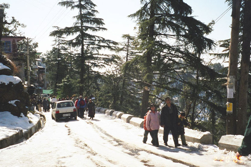
This is a hill station lying on the spur of the Dhauladhar range about 17 kms north- east of Kangra town. This hill station is wooded with oak and conifer trees and snow capped mountains enfold three sides of the town while the valley stretches in front. The snowline is perhaps more easily accessible at Dharamshala than at any other hill resort and it is possible to make a day's trek to a snow-point after an early morning's start. Dharamshala is also the headquarters of the Kangra district.
Places for INTERSECT
Chamunda Devi Temple
Just 24 km from Kangra and 15 km from Dharamshala is the famous temple of goddess Chamunda Devi (Chamunda Nandikeshwar Dham). At the back of the temple is a cave-like scoop where a stone "Lingam" under a boulder represents Nandikeshwar (Shiva). The temple complex is an enchanting spot with glorious view of Dhauladhar, the Baner Khad and Dadh. A vast running water pool houses the statues of Lord Shiva and Saraswati. A trek of about 16 km up in the Dhauladhar ranges is the ancient temple of Aadi Himani Chamunda.
Mcleadganj
McLeodganj is a small village tucked in the laps of Dhauladhar Range, located in the suburbs of Dharamshala. The Tibetan government-in-exile is headquartered in McLeodganj which has become a hub of Tibetan activities since their arrival in 1959. The highest peak of Dhauladhar Range known by the name of 'Hanuman Ka Tibba' lies in the backdrop of McLeodganj, at an elevation of 5639 metres.
Baijnath Shiva Temple
This particularly beautiful ancient Shiv temple at Baijnath is 16 km from Palampur, on the Pathankot-Mandi national highway . Built of stone in the 9th century AD in the shikhara style, it is a fine blend of sculpture and architecture. The temple is easily accessible from both Palampur and Kangra. The linga enshrined in its sanctum is one of the 12 Jyotirlingas in the country. Every year during the Shivratri fair, pilgrims decend on Baijnath for the colourful fair and festivities.
Masroor Rock-cut Temple
Known for its monolithic rock-cut temples, Masroor is 38 km from Kangra Town. There are 15 rock-cut
temples in Indo-Aryan style and are richly carved. It is a unique monolithic structure in the sub-Himalayan region and is a protected
monument.
The main shrine contains three stone images of Rama, Lakshmana and Sita. The temple complex is located on a hill and also
has a large rectangular water pond. The view of snow clad Dhauladhar is amazing from the temple premises.
Palampur
The town of Palampur (1219 m) is situated in a idyllic valley priding itself with tea gardens, and hills
covered with pine trees. The place enjoys a year-round pleasant climate and the pine scented air is said to have curative properties.
The scenery presents a sublime and beautiful contrast- the valleys presents a picture of rural innocence and repose, while the hills
are majestic. Overlooking this town are the majestic Dhauladhars, whose tops remain covered with snow for most of the year. This place
is thronged tourists and is now being developed as a large tourist centre. A ropeway and an amusement park is also on proposed to be
constructed. An Agricultural University and a Cenral Scientific Research Institute’s IHBT are pride of the town. Some tea factories
are also coming up here.
While in town one could go for one of the several pleasant walks around the town. A short walk from here
takes one to the awe inspiring Bundla Chasm which has a fall of over 100 meters to the Bundla stream. The stream is a thin streak
running over stony ground far below the cliff. During the monsoon season, it swells and rages madly over the entire width of the chasm
taking stones and boulders along with it making thunder like loud roaring noise.
Saurabh Van Vihar: In order to enable the
visitors to enjoy the nature & make them aware of the importance of nature & environment, a nature park namely "Saurabh Van Vihar"
at Palampur over 13 hactare area has been established. It is located on the right bank of Neugal Khad near Kandi bridge in the lap
of Dhauladhar ranges, in village Kwat, 4 km from Palampur town. Saurabh Van Vihar is developed in the memory of Martyr Lt. Saurabh
Kalia, who sacrificed his life during Kargil operation on 9th June, 1999. This tourist park is bounded by majestic and picturesque
Dhauladhar mountain ranges in the north and north-east. It is being managed by H.P. Forest Department through a registered society
called "Saurabh Van Vihar Management Society, Palampur".
Picnic Sheds, Childern Park, Water bodies, Health trails, Open Air Theatre,
Bamboosetum, Tiger Hill Bridge and tree, shrubs and 151 species of herbs/medicinal (including seasonal) plants are existing in the
Saurabh Van Vihar.
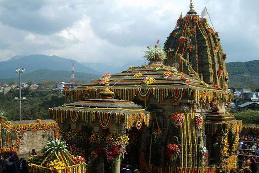
Jwalamukhi
The famous temple of Shaktipeeth Jwalamukhi is 35 km from Kangra and 53 kms from Dharamshala. Dedicated to the "GODDESS OF LIGHT", the temple is one of the most popular Hindu temples in northern India. There is no idol of any kind, the flame is considered as a manifestation of the goddess. An eternally burning and shining blue flame emanates from the rock sanctum and is fed by the priests with the offerings of devotees. The golden tower (dome) of the temple was a gift from the Emperor Akbar. Two important fairs are held here during the Navratras in earlier March/April and September/October.
Maharana Pratap Sagar
Named in the honour of the great patriot Maharana Pratap (1572-97 AD) the Maharana Pratap Sagar (Pong Lake)
is situated at an altitude of 450 metres above sea level, 32 degree north and 76 degrees east, in district Kangra. It is 170 km from Chandigarh,
110 km from Amritsar and 55 km from Dharamshala. The closest railway stations are at Mukerian 30 km, and Pathankot at 32 km. The settlements of
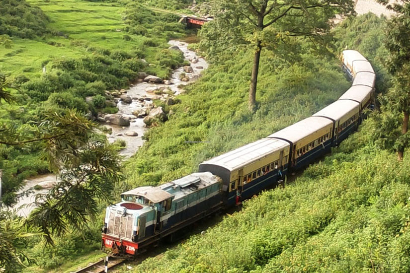
Nagrota Surian and Jawali-which are located on the sagar's periphery-are connected by the charming narrow gauge Kangra railway
line that connects Pathankot to Jogindernagar. The closest airport is Gaggal 40 km. The lake is well served by a network of roads.
Maharana Pratap struggled valiantly for freedom of Mewar-as for the principle of independence. In words of chroniclers James Tod and
william Crook, "He spurned every overture that had submission for its basis". Over the river Beas, the Pong dam was completed in 1976.
Its reservoir covers an area of about 45000 hectares at maximum possible flooding.The level varies every season and averages around
30000 hectares. Over 200 villages with a population of over 85000 people lie along the wetland.
This lake sanctuary is a big
attraction for migratory ducks from Siberian region during winter. One can see thousands of ducks in the swamp area between
Shahnahar barrage and Pongdam and the surrounding shallow waters of the lake. Clean blue water all around with the panoramic
view of Dhauladhar Ranges and Kangra Valley make the visit to Ransar Island an unforgettable experience. Black buck and Cheetal
on the island along with Surkhab, Cranes, Pintails and variety of water birds welcome the visitors on the Island. The best season
to visit the Pong Lake is between September to March. The nearest other visitable places are Masroor rock-cut temple 10 km from
Nagrota Surian railway station, Haripur fort, near to Guler railway station.
Kangra Fort
The torrential Banganga river deep in the valley forming a formidable sheer and the Kangra Fort lurking
atop the flat mountain range is a scene that one encounters on nearing Kangra town when you drive from Shimla-Mataur national highway.
A feeling of awe mixed with joy pervades you as you look back in time. The Kangra Fort is approximately 3 kilometer from the town and
is also known as Nagarkot. The fort is historically significant; its massive size, and the beauty of its structure lend it an added
charm. At the entrance is a museum containing some valuable old photographs of the fort prior to the devastating earthquake of 1905
and some exquisite stone sculptures, carvings, idols and other artifacts.
The climb leads through seven gates; en route there are
some idols embossed in the walls of the fort; the ramparts open out to the fascinating valleys below and one can recreate the past and
glide the corridors of history as one climbs up slowly through cobbled path. There are three richly carved temples in the vicinity--
Lakshmi Narayan temple, the Ambika temple and a Jain temple of Adi Narayan.
The view of gushing streams of Banganga and Manjhi
rivers from the Fort is charming. The Kangra Fort was the seat of power of the Katoch Raja's and is believed to have been founded by
Shusharma Chand Katoch. It was the ancient capital of the Katoch Kingdom and symbol of power in the Punjab hill states. The Fort of
Nagarkot (Kangra) stands as a mute witness to the ravages of conquerors from Mahmud of Ghazni (1009 AD) to the emperor
Jehangir (1619 AD) and the disastrous earthquake of April, 1905. Emperor Akbar made many attempts to capture this fort
but could not succeed. This place is now called as " Purana Kangra". One can enter the fort by a narrow path. It was protected
by a number of gates named after its winners like Jehangir, Ranjit Singh.
The fort remained neglected during the British period
but now the Archaeological department maintains it. The Fort is still an attraction to the tourists and the pilgrims visiting Kangra.
Bir-Billing
Bir, surrounded by tea gardens and an amphitheatre of low hills, is an ideal landing ground for
para-gliders. Bir has Buddhist monasteries that are worth visiting. Fine Tibetan handicrafts are also produced here. Billing,
up in the hills 14 km from Bir with an arena of 200 km for high altitude and cross country flying, is one of the best aero sports
sites in the country.
This site is regarded as among the best in the world for Paragliding. Billing (2290 m) is the take-off site
and Bir (1400 m) is the village at the landing site.The road distance between the two is 14 km. Bir is sheltered by the Dhauladhar
mountains and the ridges behind keep rising to 3000 mtrs, 4000 mtrs, 5000 mtrs and one after the other so as pilot can fly at 4000
mtrs and still watch the mountains tower above. Bir is a beautiful village surrounded by tea gardens and spectacular scenery,
whereas Billing offers unique opportunities for high altitude and cross country flying and flights of 180 kms have been achieved
from here.
All along the bottom of the ridges runs a parallel road from Mandi to Dharamshala and beyond which assures easy
recovery for
pilots after landing. The most important feature of this region is its weather. On bad weather days one can still fly 20-30 kms
and on good days 100 kms is not difficult. October & November are the ideal months for flying in autumn and March to May i.e
spring is also flyable but conditions are very strong in spring with thermals of 6-12 mtrs/sec and cloudbase of 4000 to 6000
mtrs. Palampur is 29 km and Baijnath is 13 km from Bir.